We were headed for a Southern California hiking adventure. How did we ended up sleeping under Circus Circus?
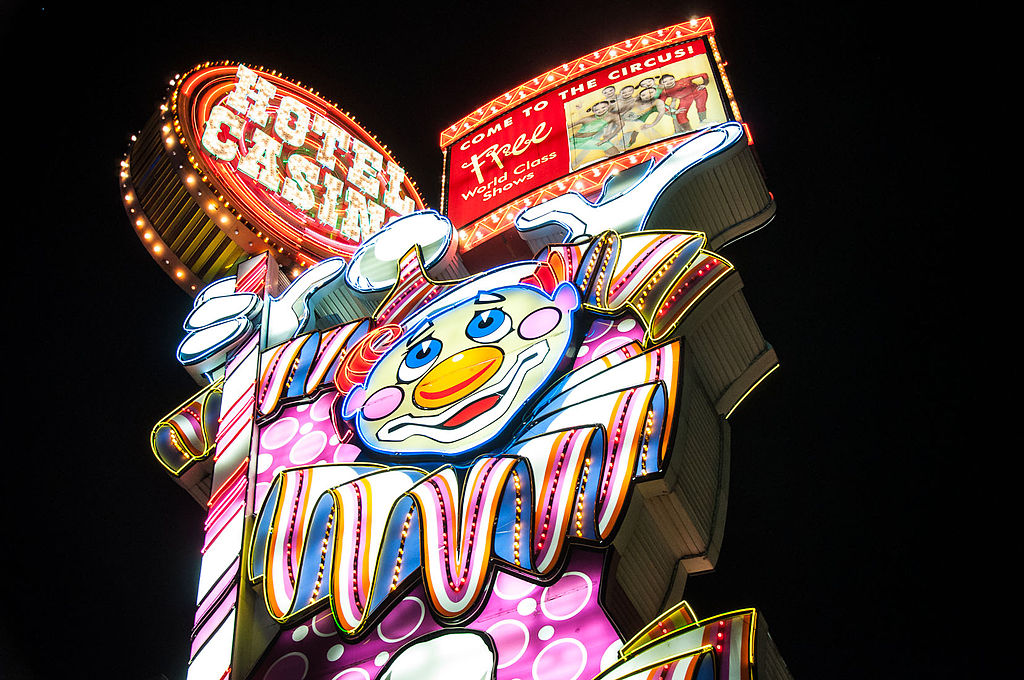
It was a cold winter in Spokane followed by a damp cold spring. We started longing for hikes in a sunny, warm place. Various friends had mentioned enjoying Joshua Tree National Park in Southern California. I read about nearby deserts and hiking areas. Dennis wanted NO big city driving so we started our trip by flying to Las Vegas. I found a very reasonably priced Travelodge which I thought was on the edge of town and close to the Las Vegas Airport. It wasn’t that far to leave Las Vegas but our small 2-story motel was in town on the edge of the casino strip. We were almost under the towering Circus Circus Casino.
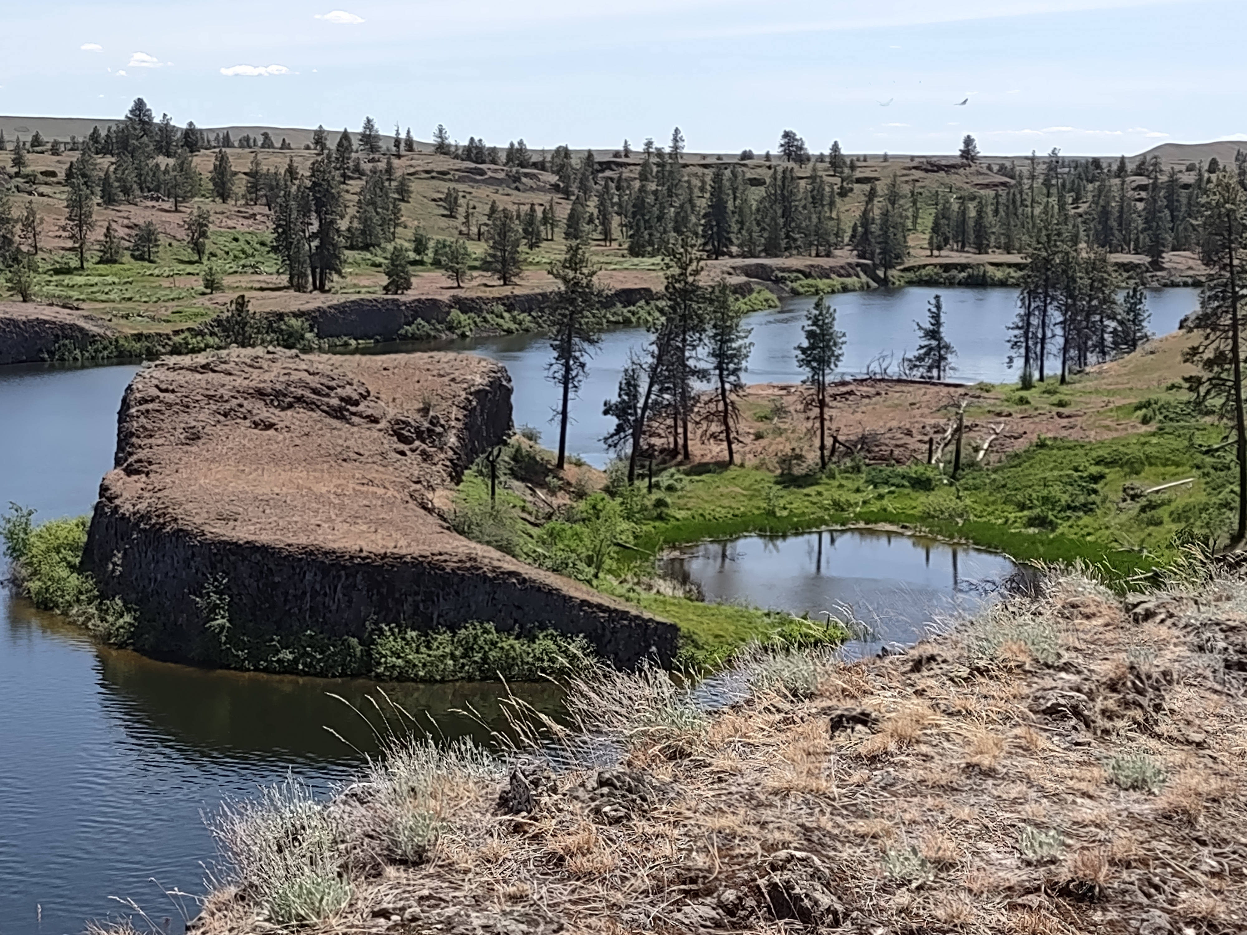
The next morning the scene changed completely when we headed into the Mojave National Preserve.

We took two short hikes. The first Rock Springs Loop Trail took us from the remains of WWI veteran’s small ranch thru the site of a former military camp, and along the now dry Rock Springs.


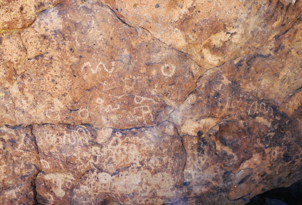
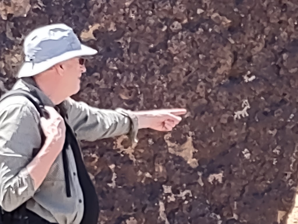
We drove to the self-service Visitors Center. Lunch was our travel emergency granola bars. We hadn’t really considered that we were headed into a mostly uninhabited nature preserve. We didn’t see any grocery stores on the way. We hiked the Hole-in-the-Wall Nature Trail and the Ring Loop Trail which was a very tight canyon passage. I learned Dennis is a genius in sighting petroglyphs.


Ring Loop Trail

The Ring Loop canyon passage was narrow and harder than it looked. Dennis pushed me and I pulled him.
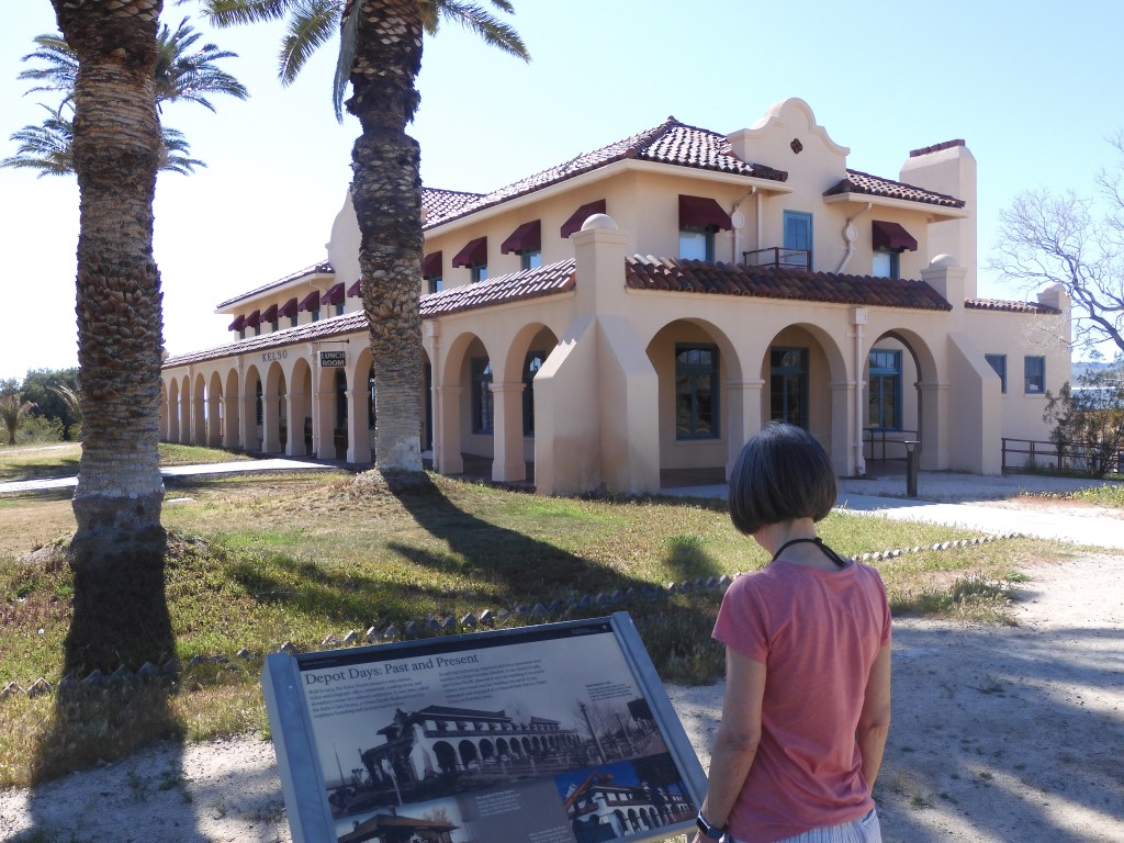
On our way out of Mojave we stopped at the Kelso Depot Museum. The museum was closed but we admired the once bustling depot and hotel. We spend the night in the town of Barstow which was our first time on Route 66. I can’t say much for the town. We couldn’t find a grocery store on Route 66 but we did find a jar of peanut butter. We ate dinner in a nice Mexican restaurant. The restaurant was part of a restored Quality Inn. If I were forced to stay in Barstow again I would book this motel.

Joshua Tree
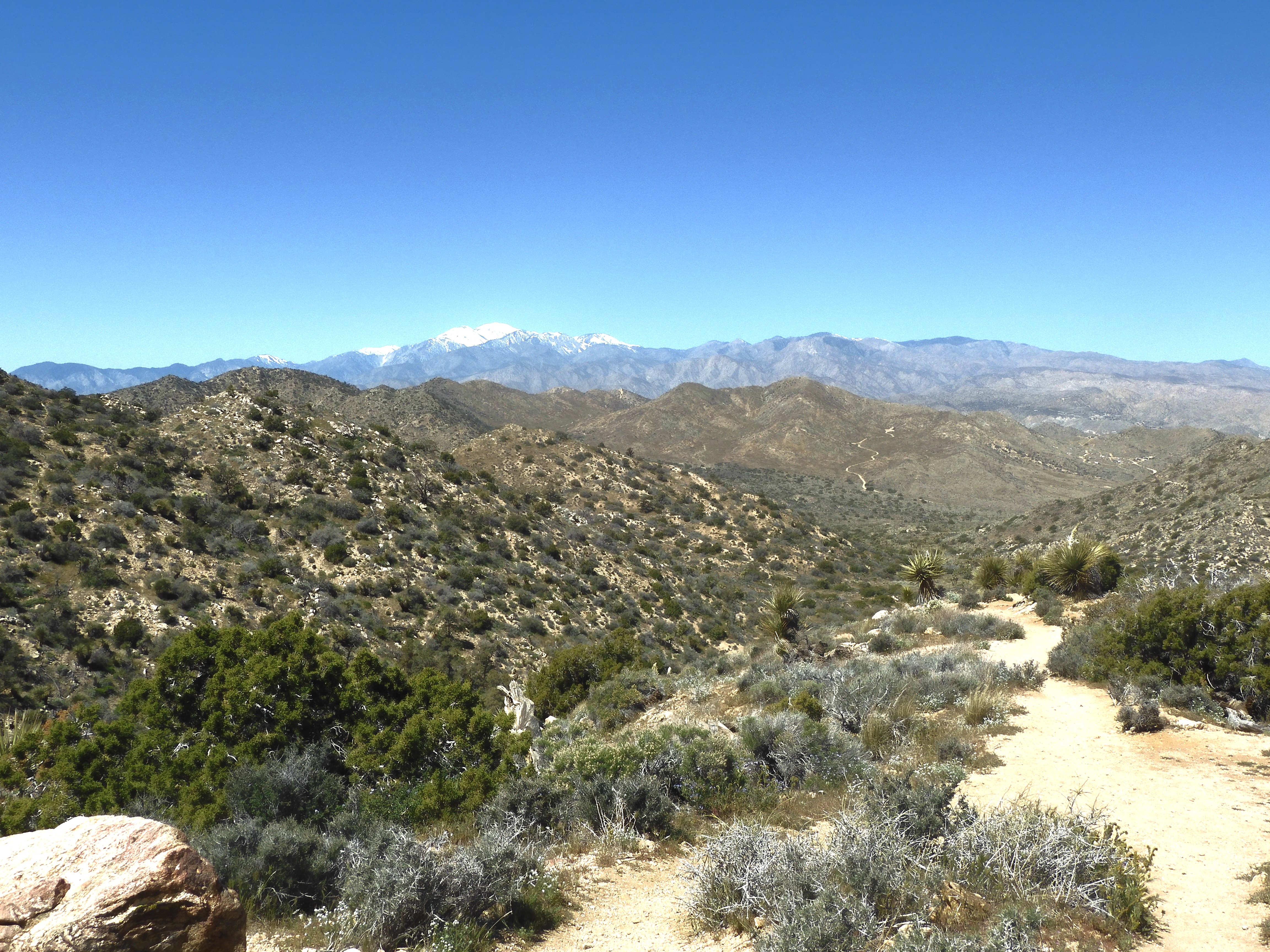
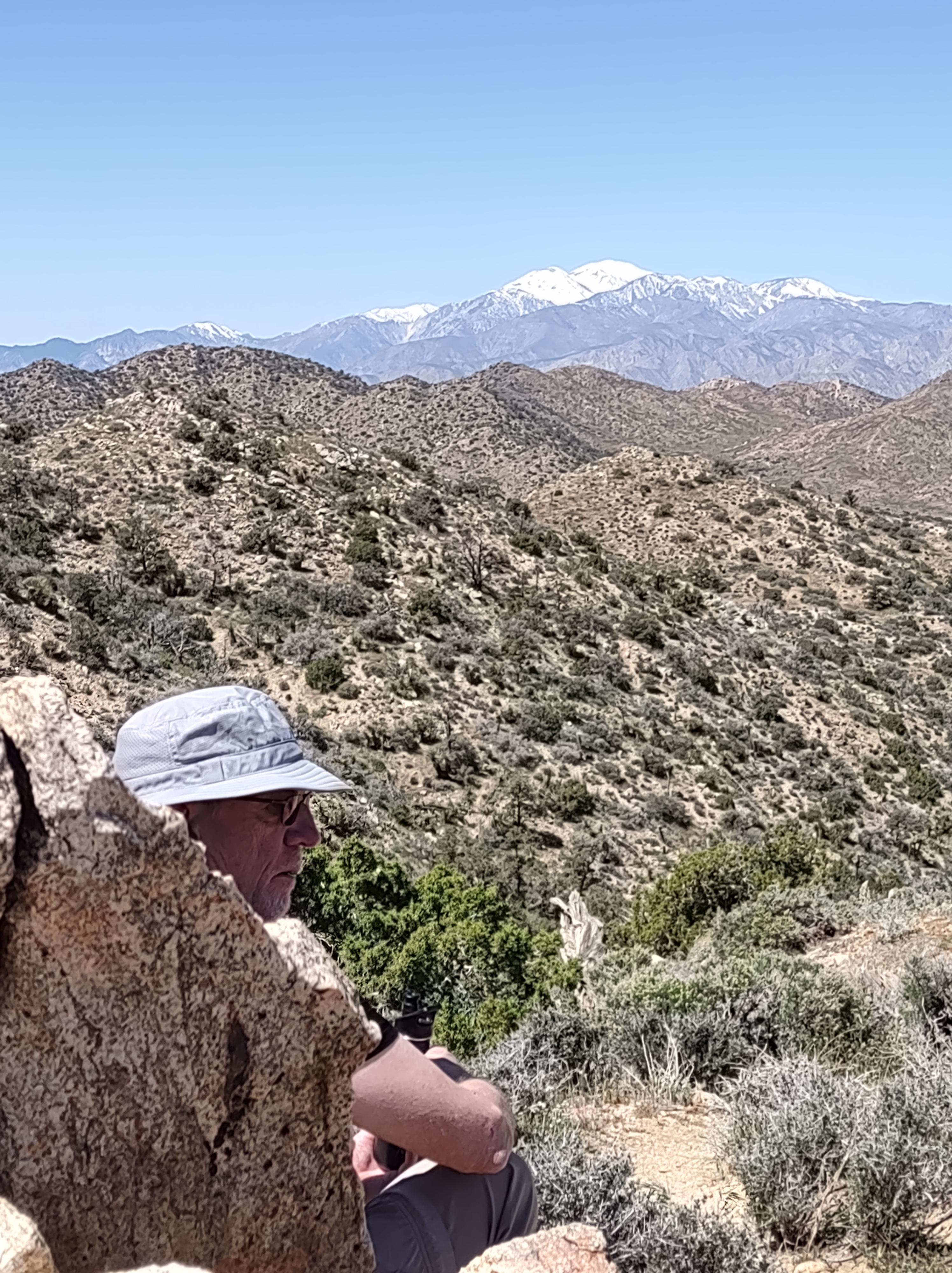
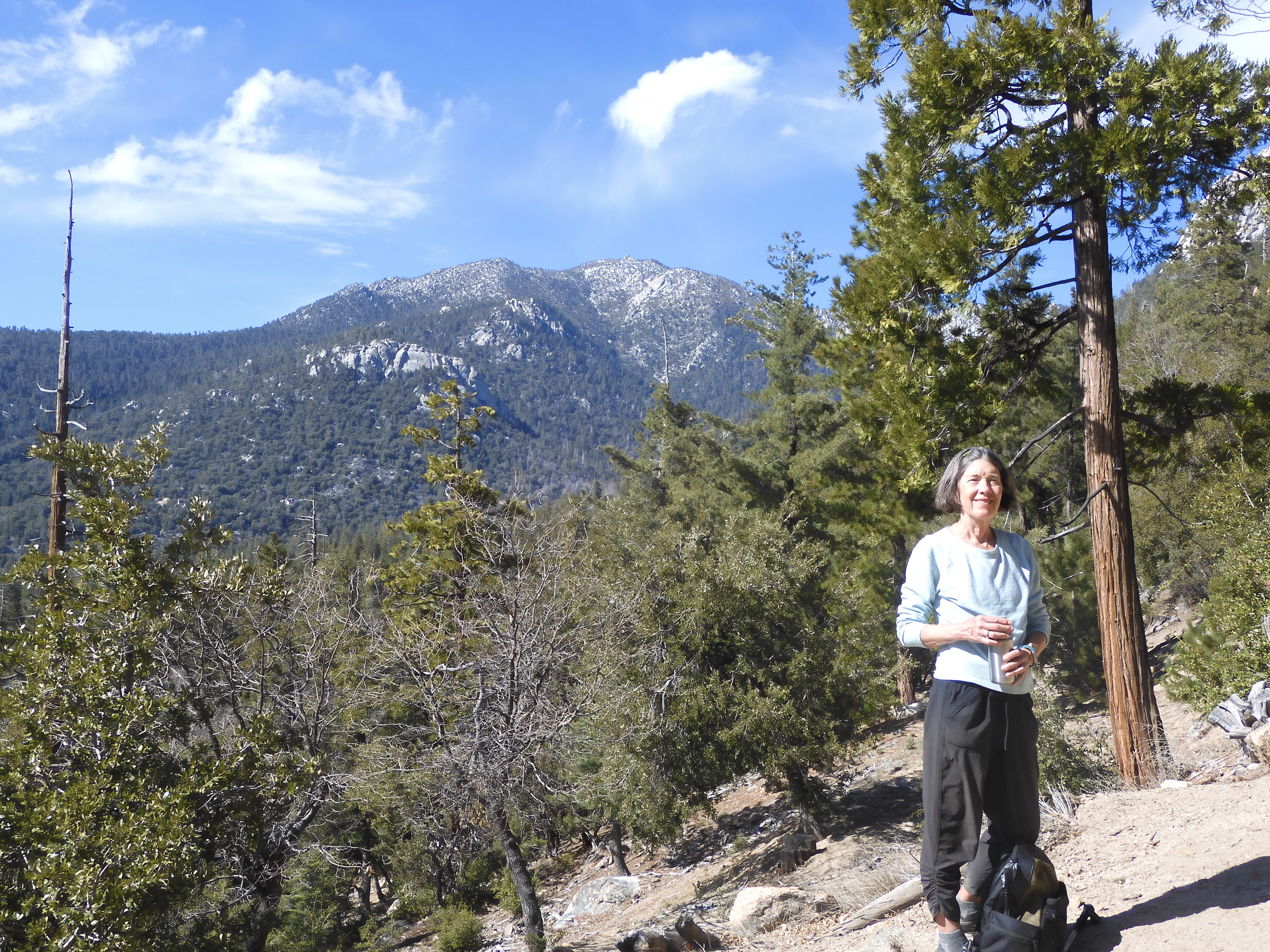
The next morning we drove to Joshua Tree National Park. Finding our way to the northwest Black Rock entrance required pulling into a parking lot and both of us consulting Google maps then pointing in different directions. The route Dennis choose was correct although it wound through miles of suburbs with little signage to guide us. We arrived at the the High View Loop Trail about a 2 mile climb up and around a mountain. (I’m from the Midwest so a steep hill with rocks on top is a mountain.) I think this was our most spectacular view of the ranges of snow covered mountains to the southwest.

After our hike we made another circuitous drive to the West Entrance Visitors Center where we learned they are no longer able to provide paper trail guides. I like it when you talk to the Ranger and he or she circles the hikes that are best for you. Recently the park personnel we’ve encountered have also had to explain what roads are under construction often due to floods or areas closed due to fire or mudslides or something. At Joshua Tree that that information is posted and the rangers suggests that you take a photo. As a person who dislikes fiddling to view my phone in the middle of nowhere possibly in sunshine, I was disappointed, I understand. The West Entrance Center was crowded with visitors. Guess I really should start donating to that national park foundation that keeps sending mail. As a former Girl Scout I was somewhat prepared. I’d bought a HUGE map of Joshua Tree at REI in Spokane.


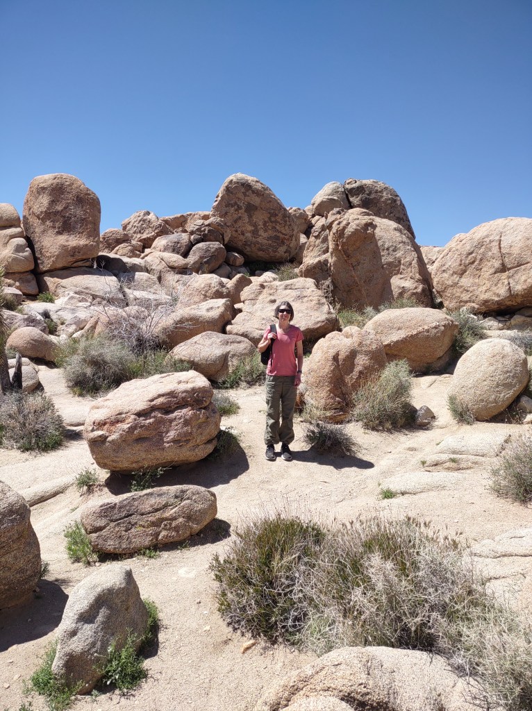
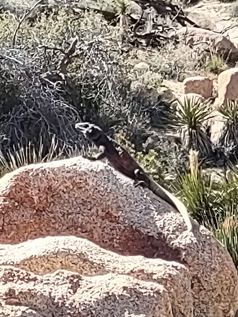
We ate our peanut butter lunch at at a picnic spot with some very BIG boulders. Fortified we hiked a loop to Barker Dam and then one of our favorites, Hidden Valley Loop. Hiking the Hidden Valley box canyon we saw 2 Chuckwallas. The largest lizard I’ve seen in the wild.
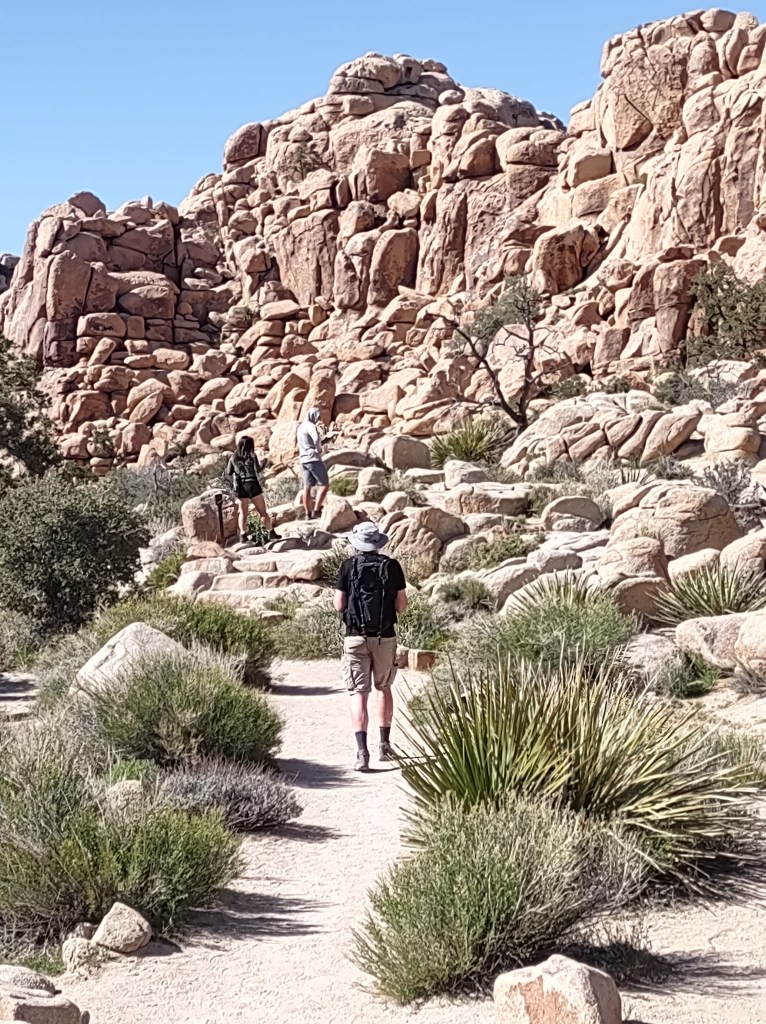

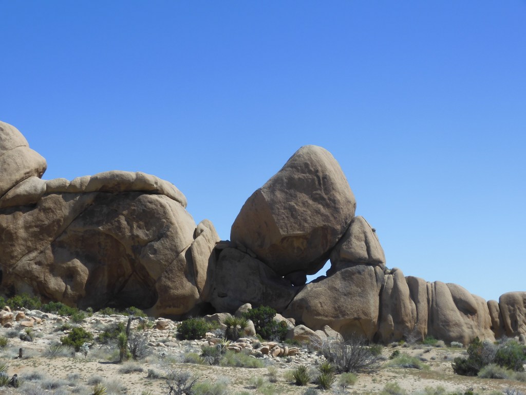
Split Rock, Skull Rock, Jumbo Rocks, Cap Rock, Arch Rock, and Heart Rock
No wonder Dennis complained that we had to walk 10 minutes just to get a closer view of Heart Rock. It was our last rock of the very hot and rocky day. We got an early start so that we would be able to get a parking place at the Split Rock Trailhead. It was a beautiful morning and not crowded as we started on the loop including the Split Rock, Skull Rock and Discovery trails. It was interesting and somewhat varied topography but after a while you start to see a lot of big rocks that look like skulls or dragons or whatever you are supposed to be looking for. The signage was mostly pretty good but we did keep consulting our GPS & paper map especially after some women on the trail thought they were lost and asked us for directions to the parking lot. “Wait didn’t you just come from the parking lot?” They denied it but we thought our question must have been lost in translation.
After our usual peanut butter picnic & nature hike at Cap Rock we proceeded to the Arch Rock Trailhead and Heart Rock. We stopped on the way to walk around the the Hall of Horrors which is another fantastic rock structure. Apparently a big attraction for climbers.


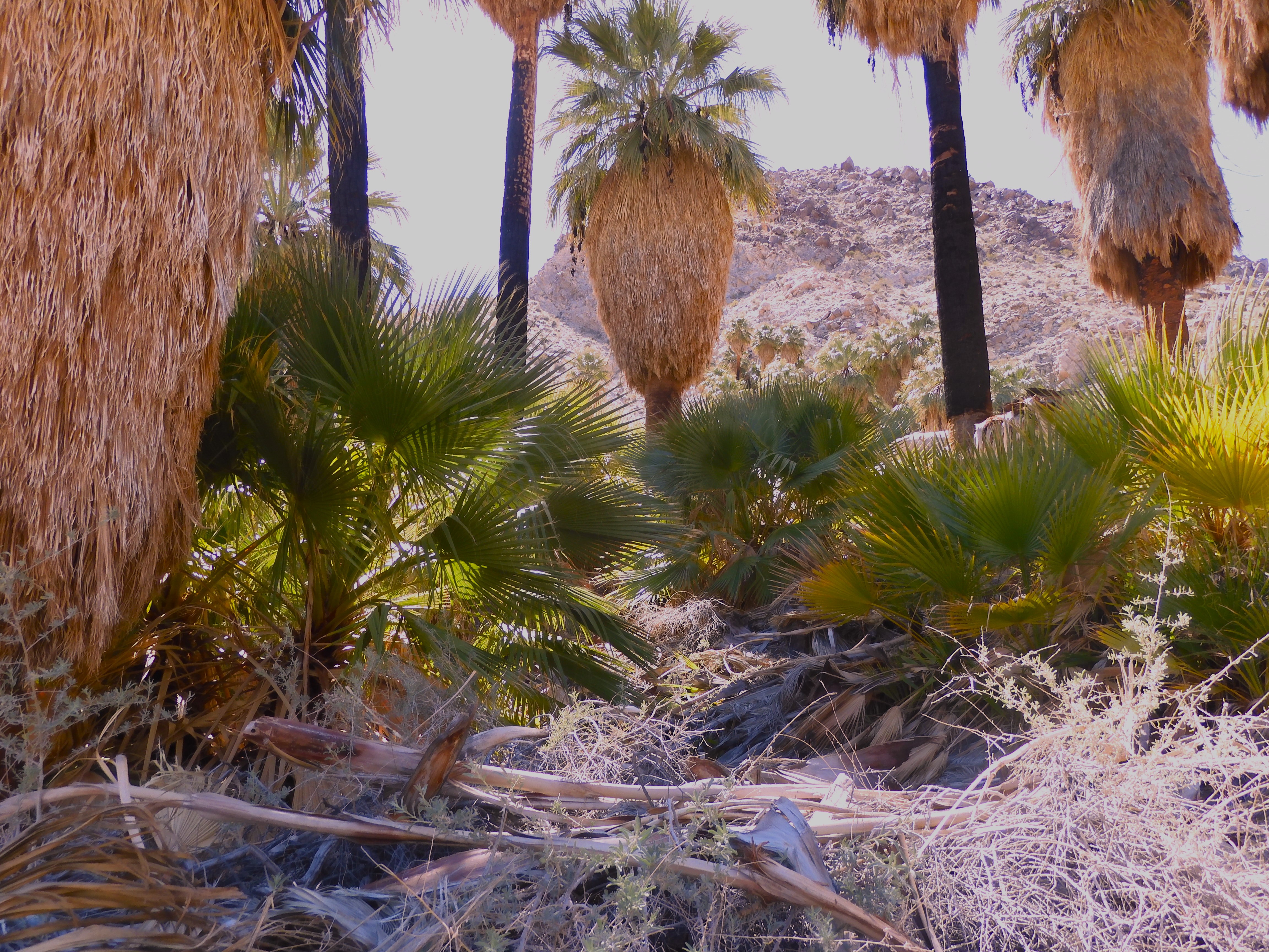
You never forget your first Palm Oasis
We spent 2 nights in the town of Twentynine Palms. Our last hike leaving Twentynine Palms was to Forty-Nine Palms our first Palm Oasis. It’s amazing to hike 1.5 exhausting hot miles up and down a dry rocky mountain and find a wild California Palm trees growing by a stream.

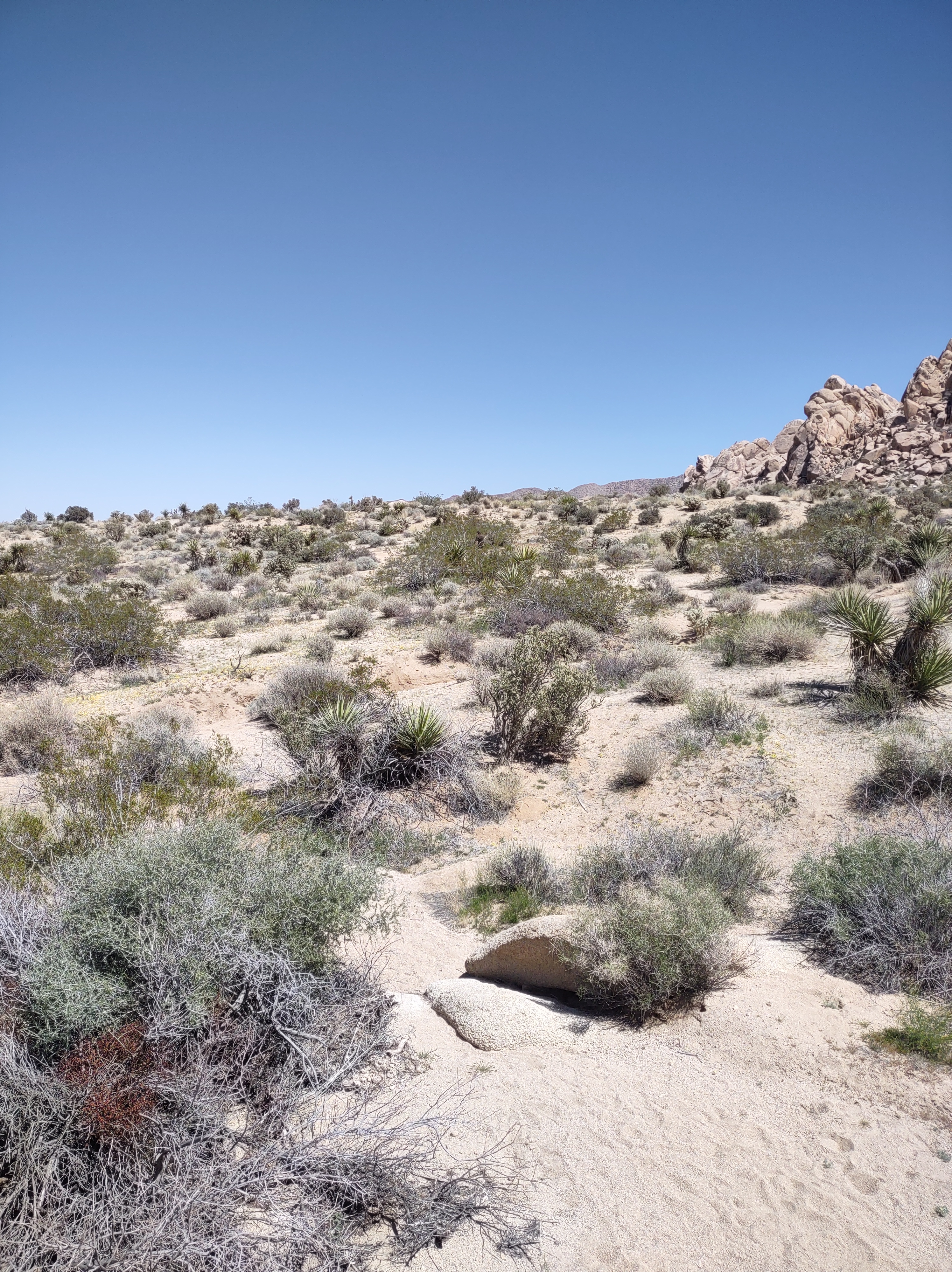
Looking for someplace to have our peanut butter lunch before driving to Palm Springs we went to Indian Cove Campground and Picnic Area. Fortified we decided to explore the short Indian Cove Nature Trail. No rocks to climb but oh so very easy to lose the trail. Did I mention, ALL the afternoon hikes were quite HOT. 80+++ I love those sunny Southern California skies not a cloud in sight.
Indian Cove we lost the trail a couple of times. It’s here somewhere.Palm Springs
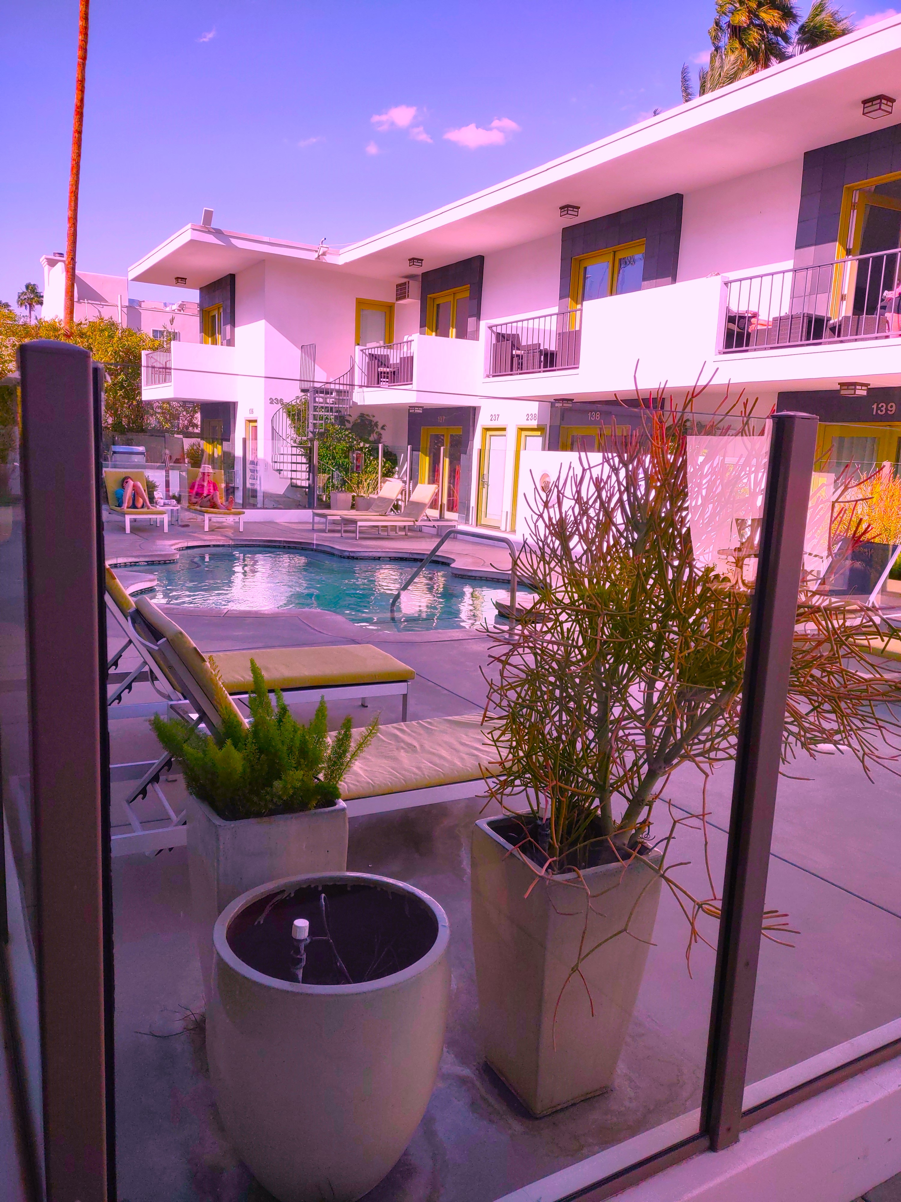
I never heard of the Coachella Music Festival. Dennis knew about it but he had no idea exactly where Coachella was or when the festival was be held. The answer was near Palm Springs and our first weekend. Dennis had asked me to make sure we had a room in Palm Springs for the first Saturday & Sunday we were in Southern California. He feared a weekend in the national park would be a zoo or as Dennis likes to put it “We’d be hiking in a parade”. Finding a motel in Palm Springs for Saturday night was hard! I was amazed that the price of our motel room, oops I mean resort, was $200 less on a Monday night.
That was something I’d never encountered in making a motel reservation. My online search only yielded 1 motel available in central Palm Springs, all the others options were Spa-Resorts. I don’t know what makes something a “resort” but a swim in one of the two swimming pools at the Seven Springs sure felt great after a hot hike.

Dennis’s cousin Jane who rents a condo in March & April, really helped us enjoy Palm Springs. Jane suggested a Cuban restaurant for our first night and a Mexican place for our last night. The night in between she cooked us salmon. Jane gave us a tour of the downtown neighborhood around our motel resort. There was a really nice art coop and a great place for coffee nearby. Also, I never knew that Palm Springs originally attracted the Hollywood stars that loved horses. Then there is the Native American struggle to get restitution for Section 14. Lots to learn and see in Palm Springs. Jane explained some of the history & provided us with maps, the paper kind that I like.
Sunday afternoon we hiked up Tahquitz Canyon. The destination a snow melt fed waterfall with lots of people wading in the very cold water. The excitement on the way up the trail was the necessity of stepping past a red diamond rattlesnake. I had no fear until I was walking on the trail adjacent to the snake. That’s when I saw how BIG it was. The ranger assured us the rattler wasn’t in striking position.

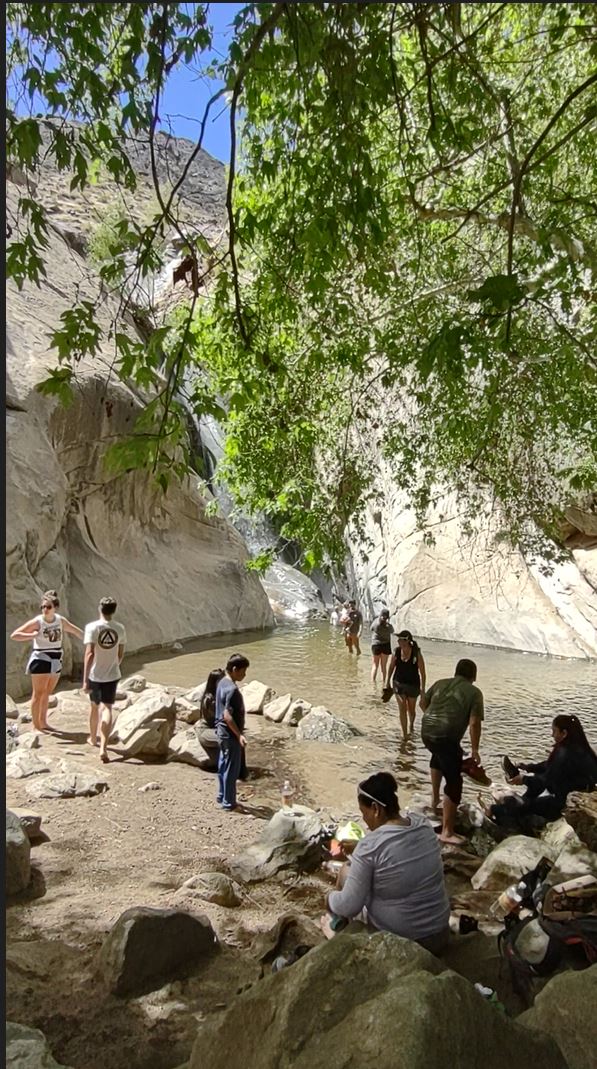
We enjoyed the views of Palm Springs on the way down the valley. There were even a few clouds.
We rushed from our hot hike to the Agua Caliente Museum. My friend Diane told me it was a must.

This is a beautiful modern museum with lots of information about the culture, history and art of the area tribes.
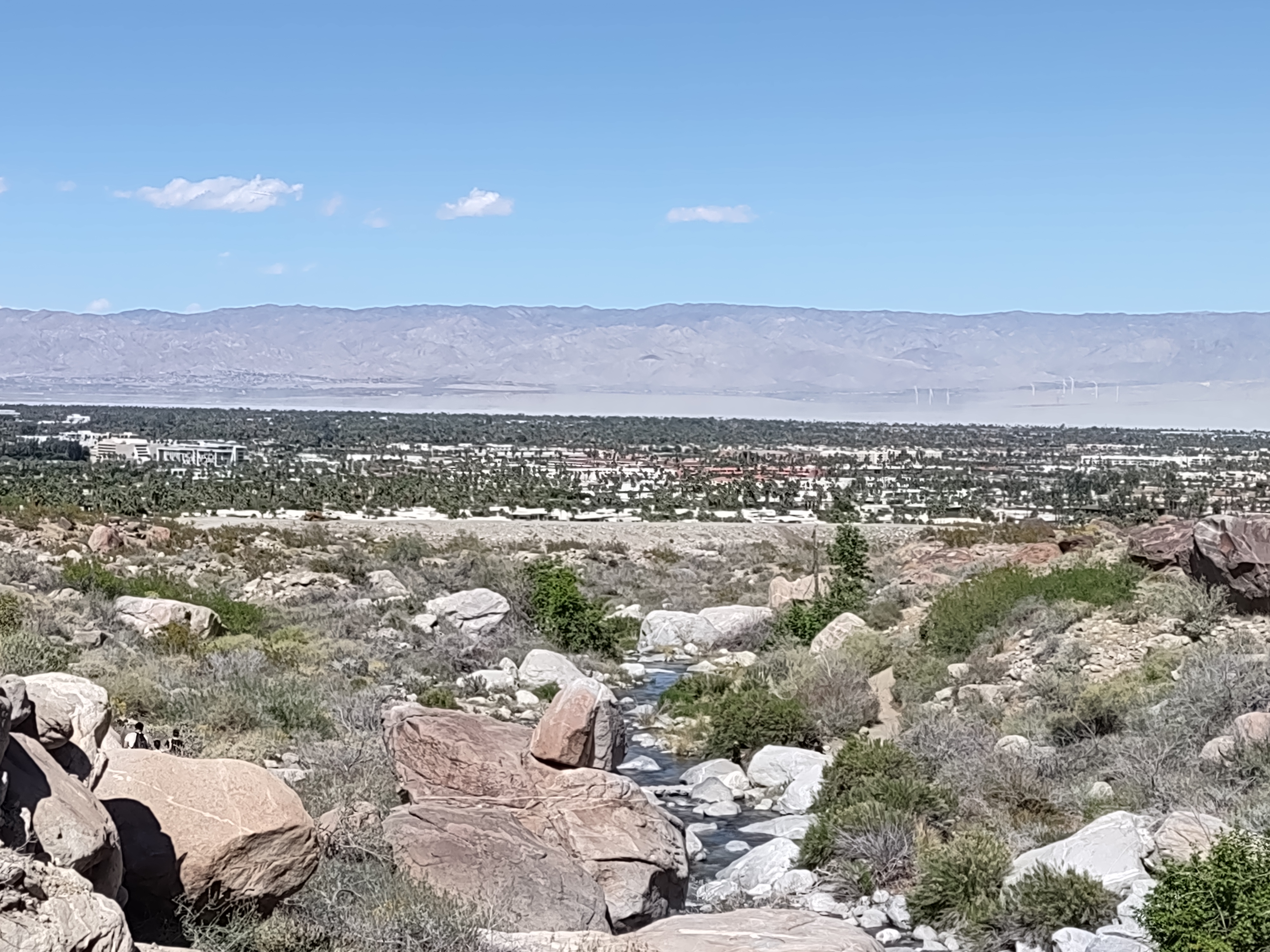
The next morning we picked-up Jane for a hike in Indian Canyons. Like Tahquitz Canyon this area is controlled by the Aqua Caliente Band of Cahuilla Indians. The tribe has their own park rangers on duty and charges for admission. You are required to carry water. Senior rate for admission to Indian Canyons was $7.00 each with discount coupon. With paid admission you get a nice map which you might need in Indian Canyons. There are 3 canyons and they are pretty big. We headed for the Palm Canyon Loop.

Leaving Palm Springs
In spite of Jane’s good directions for finding “The 111″ out of town on our way to the Saltan Sea. We exited following the DETOUR” sign and lost our way back to “The 111” but what could be more Palm Springs than long drives on Dinah Shore Avenue intersecting Bob Hope Drive, a long stretch on Fred Waring and crossing Gerald Ford Drive. Somewhere past the Sonny Bono Memorial Highway we found our road.
Anza-Borrego Desert State Park
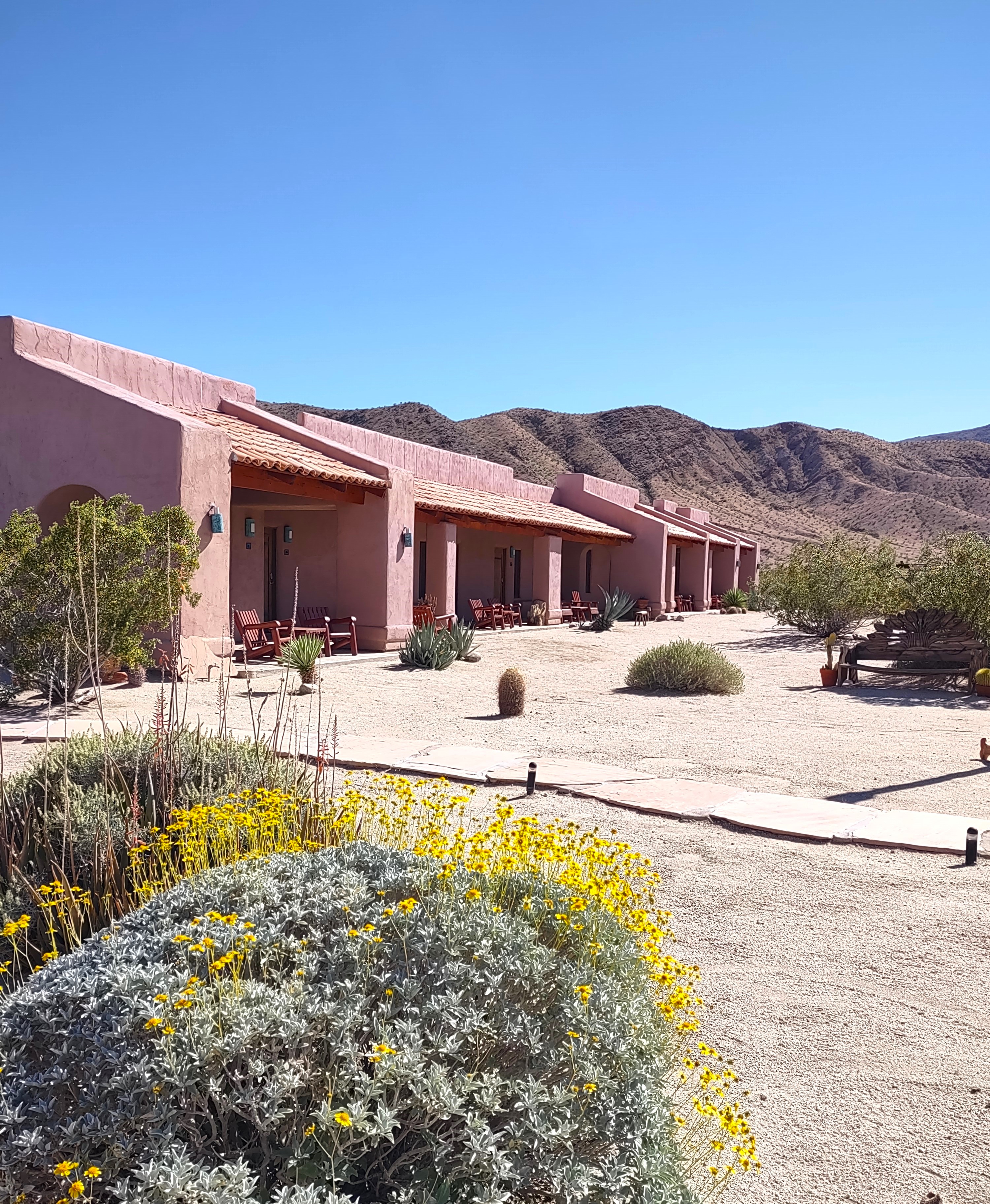
Our motel resort in Borrego Springs was very clear: no check-ins before 3:00pm so we had plenty of time to visit the Anza-Borrego Park Visitor Center and hike the Center’s nature trail. As for our peanut butter picnic, every table in the shade seemed to have a person permanently parked there. I guessed that they were planning a long stay by the thickness of the books people were reading and the large size of their water bottles. We did not envy the people camped down the road. Temperature in the shade was about 90. Dennis concentrated on admiring the desert plants along the Visitor Center trail.

Nothing to do in the afternoon heat but and rest in our “casita” and check-out the swimming pool.

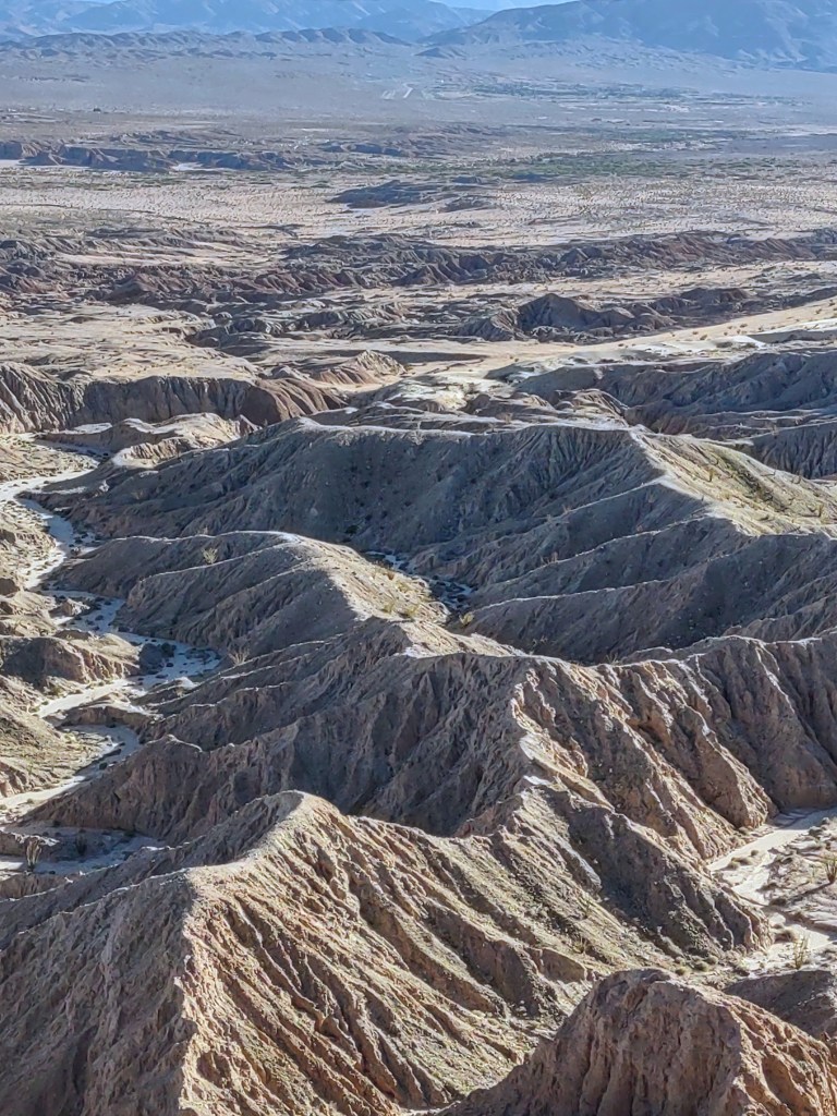
I spurred Dennis into action about 4pm. A friend in Spokane told me the thing to do in Borrego Springs is to drive the 4-wheel- drive road to Fonts Point and watch the sunset. This is when I discovered the Toyota Corolla Cross SUV we rented in Las Vegas is not all-wheel drive. How can you call a car a “Cross SUV” if it can’t drive up a sandy road? We made it but I could tell Dennis was not enjoying himself. He was only thinking about making the drive back. He said it was like driving thru snowdrifts, if you stop you don’t know if you will be able to get out of the hole your in. I thought the view was worth it but I wasn’t driving.


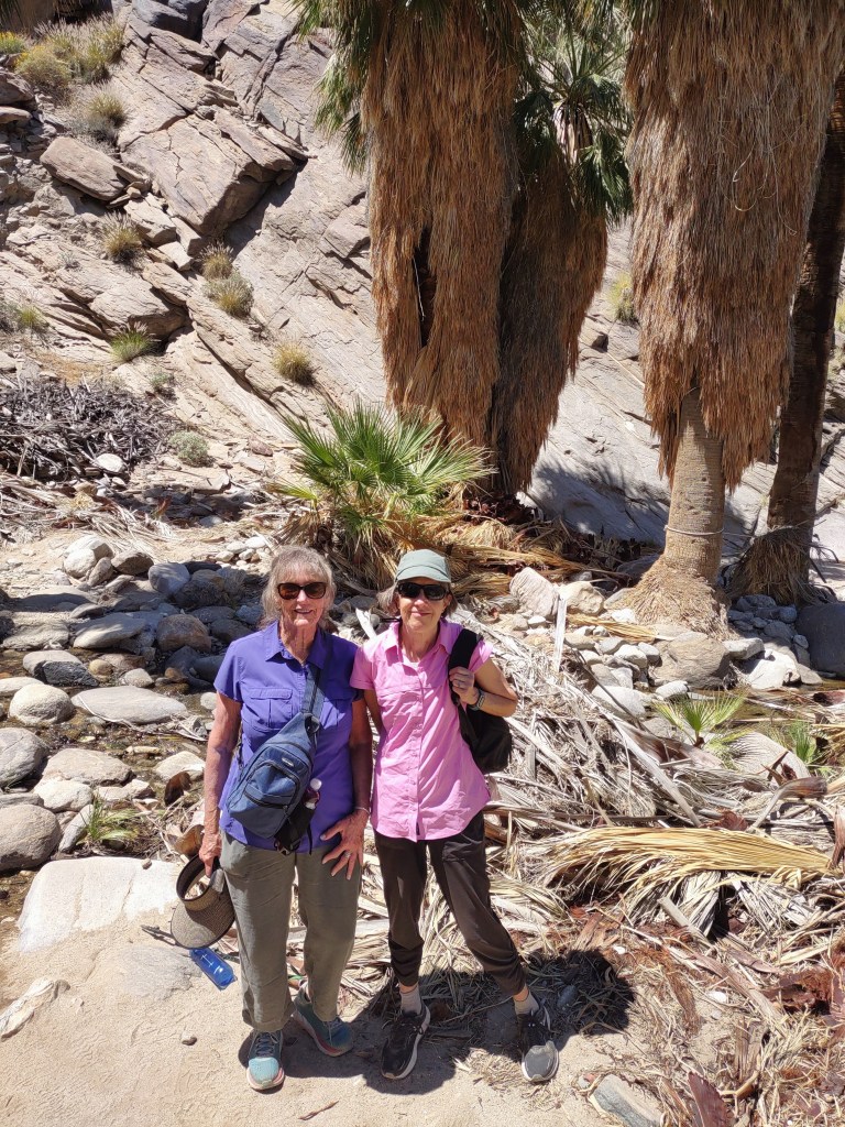
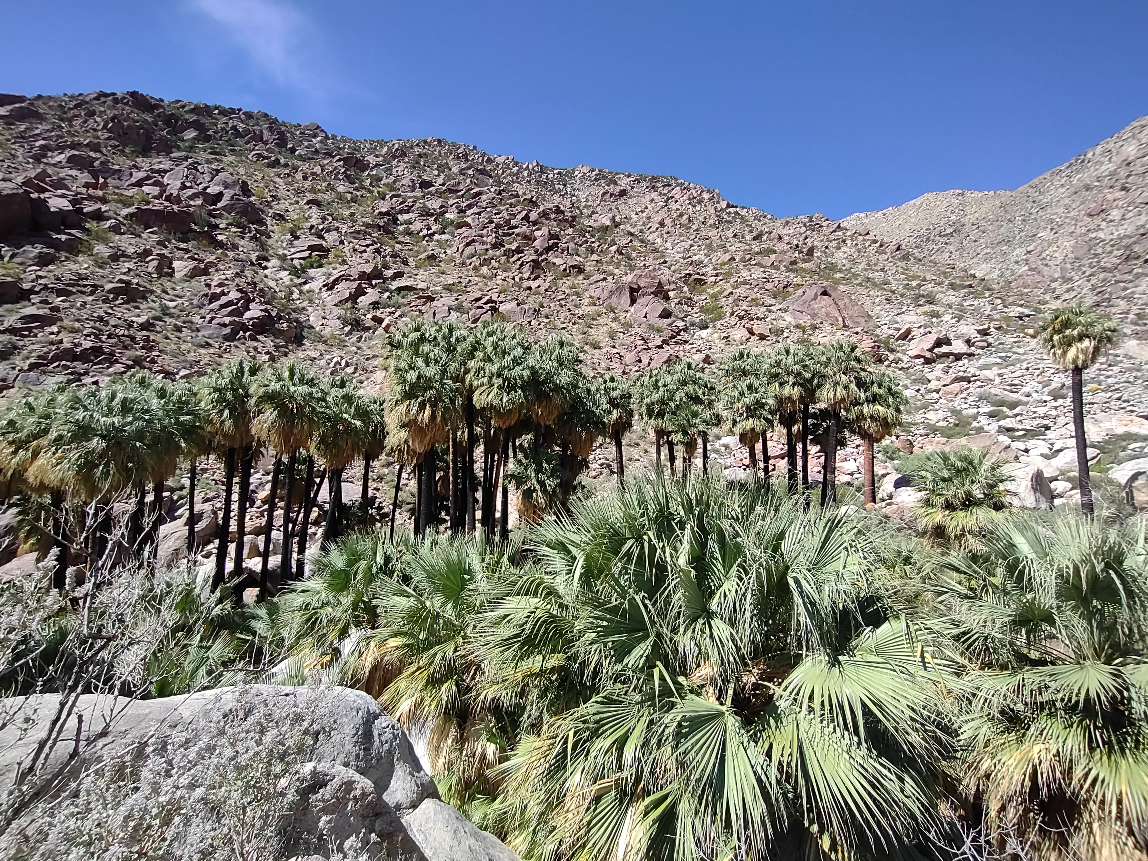
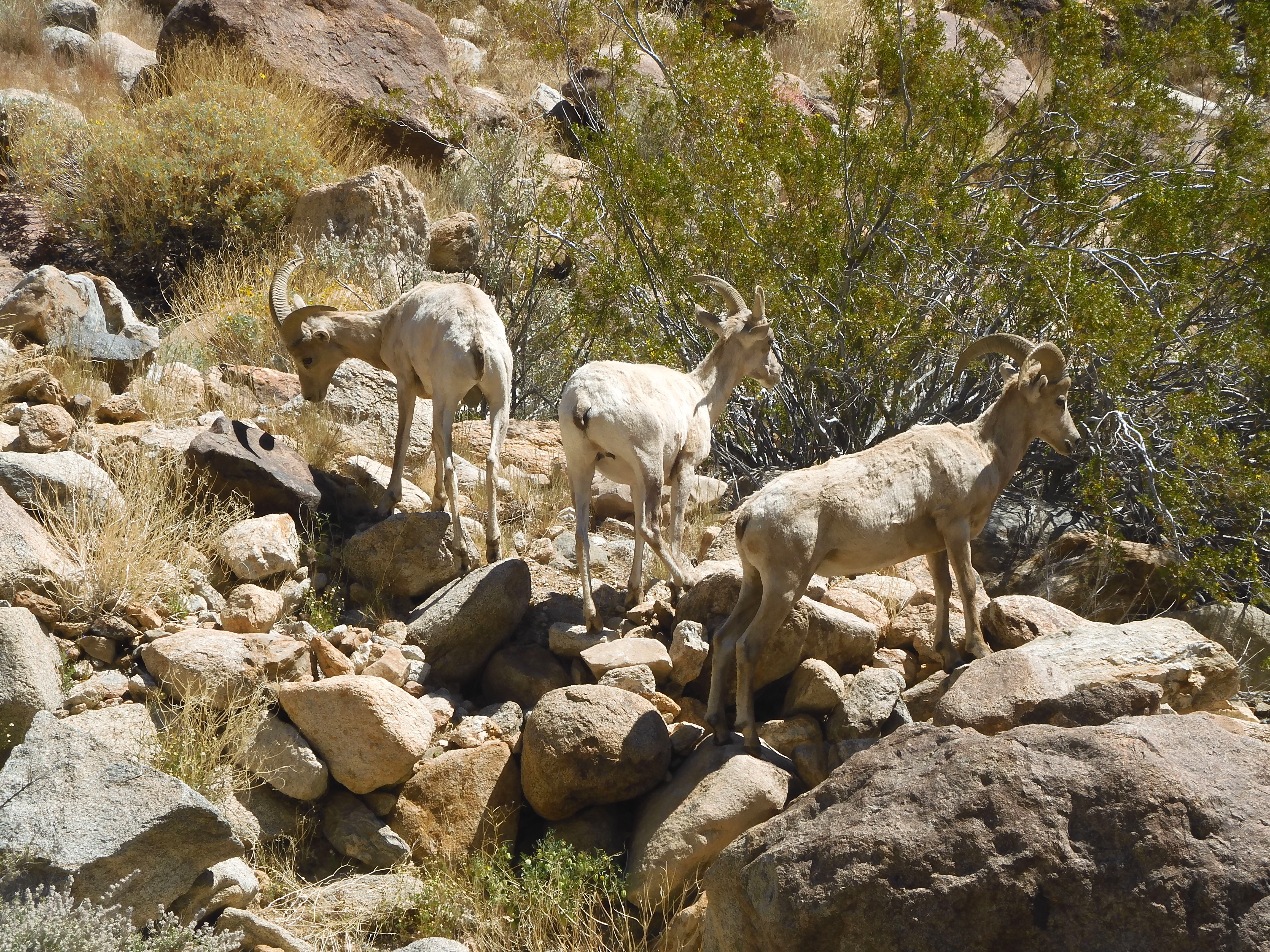
The next morning we drove to the Borrego Palm Canyon Trails right after breakfast which isn’t served until 8am. I loved hiking to the palms and the definite end to the trail. Also a bonus, we saw a couple of herds of Mountain Sheep. The word “trails” was what got us in a little trouble. We decided to take the “Alternative Trail” indicated on our map back to the trailhead. We lost the trail and spent some time wandering in the desert looking for it. The untracked desert is beautiful and luckily there is a stream flowing down to the campground/trailhead so you can lose your trail but not your car.


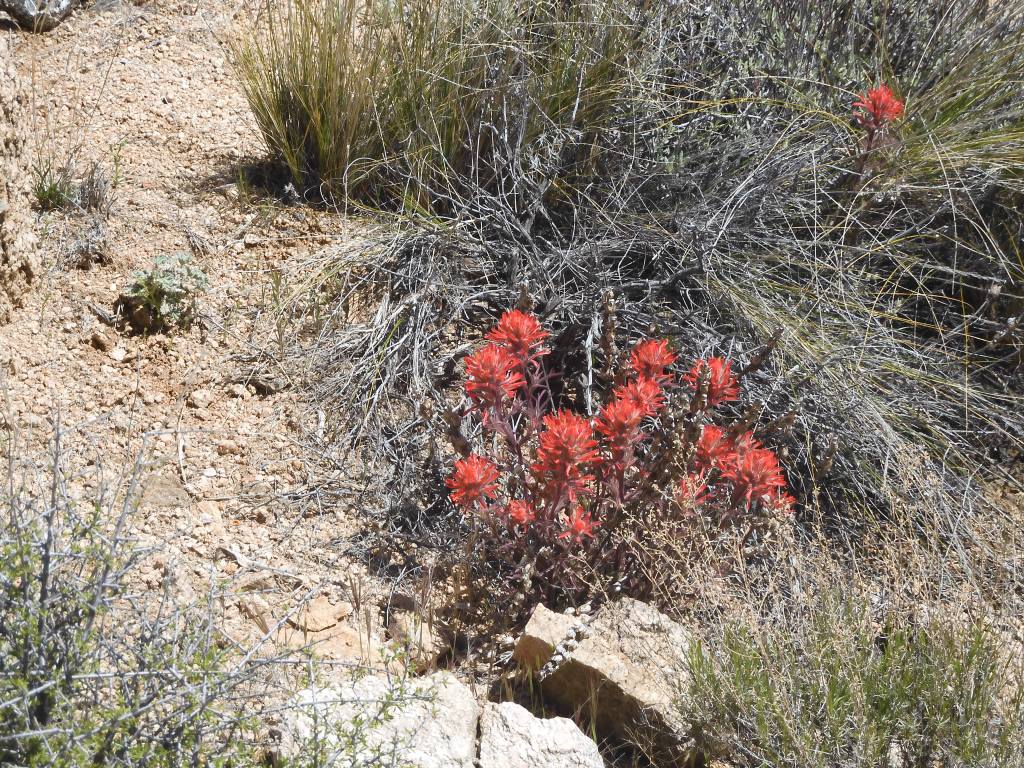
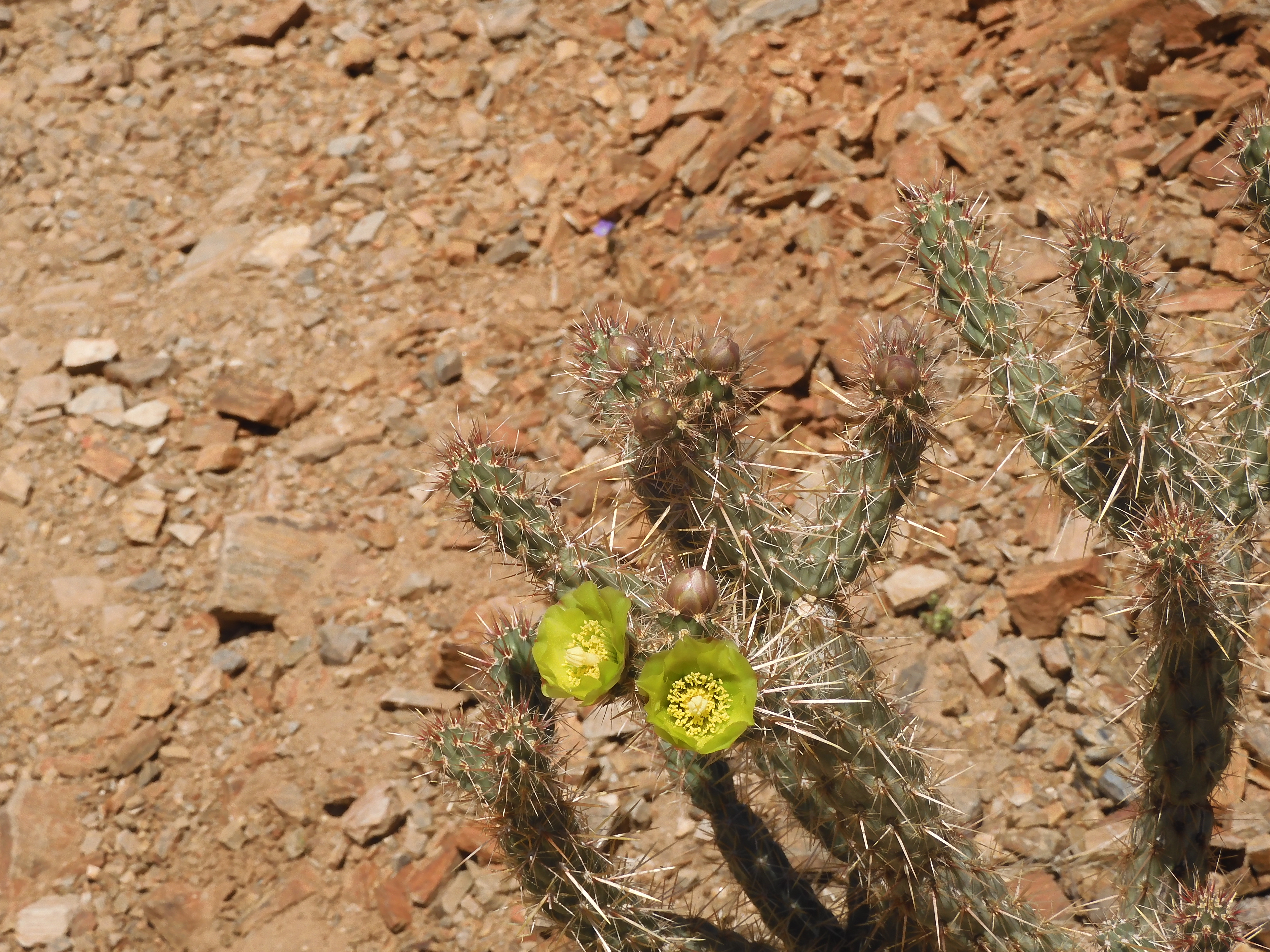
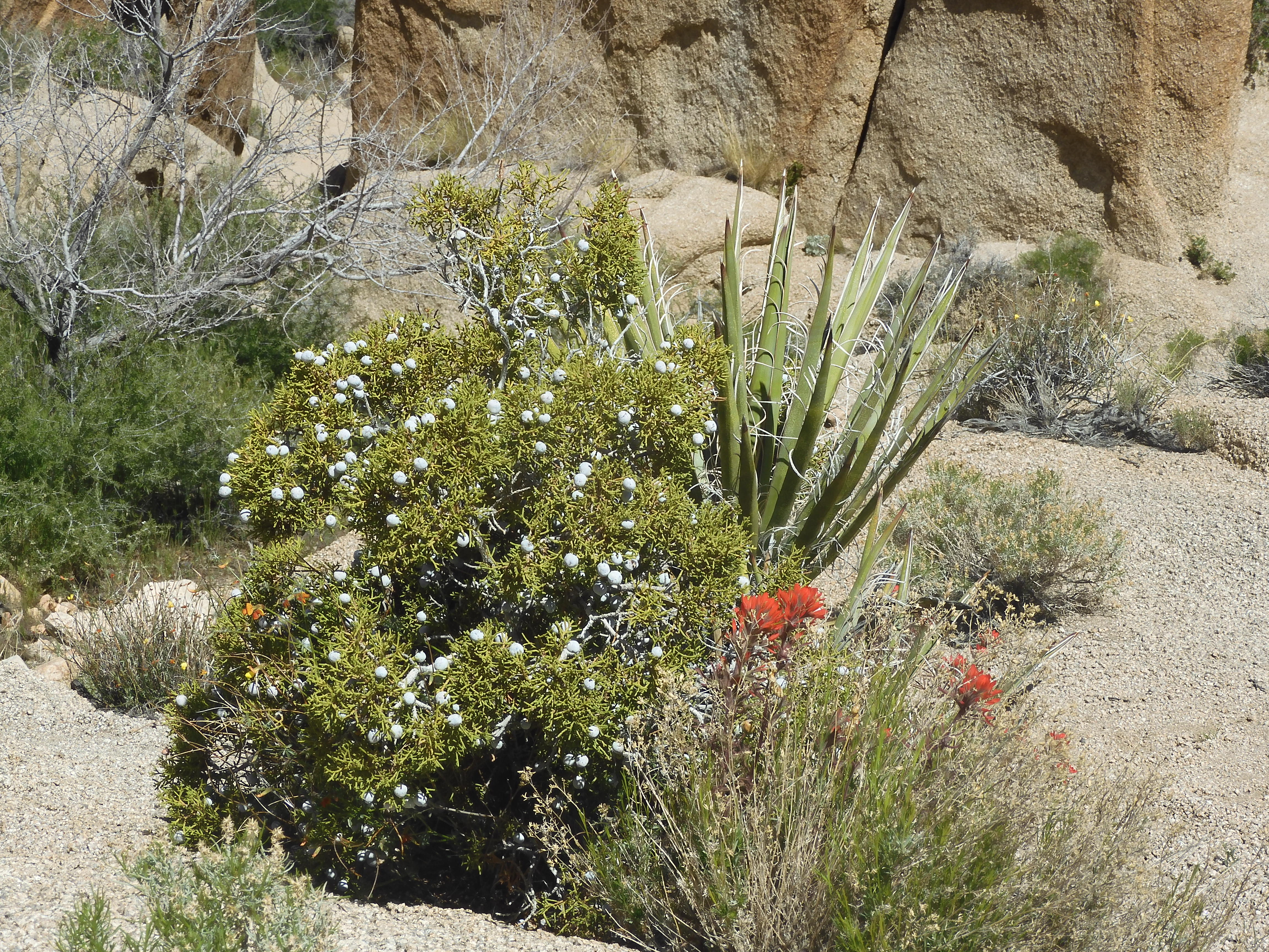
Mid-April is supposed to be past the usual peak of cactus blooms but we were wowed by the desert flowers especially in Borrego State Park.


We saw slopes of red Ocotillo in bloom. These became my favorite cactus. It’s hard to capture the wonder of seeing various desert plants especially cactus flowering in their dry rocky surroundings.


We stayed in Borrego Springs 3 nights and did 5 hikes most of them short. One exception “The Slot” a canyon hike that the hiking guide claims is a 1.5 miles. We took some dead end paths and climbed some high rocks to find the trail and ended up going back the way we came. All of it was a beautiful adventure or seems so now.


Leaving Borrego Springs
I was a bit sad to leave Borrego Spirngs but we had hiked the Borrego Palm Canyon Trail, The Slot, Cactus Loop Trail, Yaqui Well Nature Trail, Little Surprise Canyon Trail and William Kenyon Overlook. The daytime temperatures were getting higher than we’d hoped. The average April temperature high in Borrego Springs is mid-80’s. We were having highs in the mid-90s every afternoon. Great for afternoon swimming and reading in the shade. Not so good for any afternoon activity in the sun. Other than the the slot canyon hike we found there was no such thing as a shady desert hike.
Idyllwild
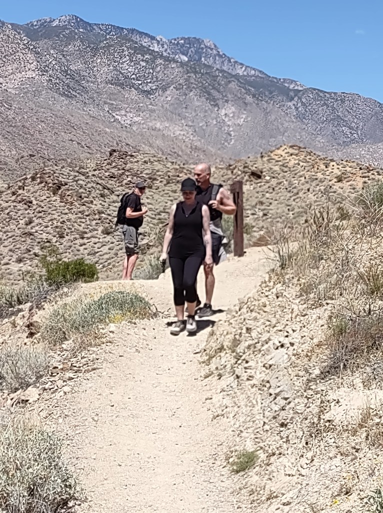
Our next stop was the town of Idyllwild. Two hours away and 30 degrees cooler. Idyllwild is a mountain town with too many tourists to call it quaint. There are gift stores, artists studios & galleries, sports outfitters, and signs claiming ORGANIC or NATURAL everywhere. As long as you can handle the steep slope, it’s very walkable, making it easy to find coffee, ice cream and all types of restaurants.

Our first stop was the Ranger Station where we got a trail guide to the San Bernardino National Forest and some hiking suggestions from the ranger. She seemed stumped when Dennis told her that he preferred trails that were no longer than 3 miles total. She suggested the Ernie Maxwell Scenic Trail for our afternoon. “It’s 2.6 miles one-way but you can turn around anytime.” She suggested we fill out a Wilderness Day Use Permit for Deer Springs Trail 2.3 miles continuing to Suicide Rock another .5 miles. “Why don’t you just turn around when you get tired.”
A couple of hours hiking up and down Ernie Maxwell got us adjusted to hiking in a forest at some altitude with trees, rocks and shade, lifting our feet instead high instead of shuffling around the cactus.
The next morning we turned in our permit and started up the Deer Springs Trailhead by 9:00am. The parking area was already full. As we climbed I could really feel that I was hiking almost straight up a mountain at altitude a bit higher than I was used to. We persisted and it got better. We made our 6 mile hike, climbing thru some snow to get to Suicide Rock. You can see it was well worth it. No temptation to jump.

Back to Joshua Tree
After two nights of turning on the heater in our Idyllwild cabin we headed back to do a couple of hikes we’d missed in Joshua Tree. It was SO HOT in the 90’s we did just one hike to Mastadon Mine from the Cottonwood Campground. We were very glad we weren’t camping! Hiking was hot but not impossible. We had the trail to ourselves although we did see one nude hiker heading in as we were hiking out. He ducked behind the rocks as we approached. I didn’t know nude hiking was a thing especially in full sun in the warmest part of the day. As always the rocks and desert scenery were amazing.


After one night revisiting Twentynine Palms we were off to someplace, we didn’t know where, for one night before heading to Las Vegas for our flight home. Dennis said he had heard of Bullhead City, AZ. He thought it should be scenic. A convention of some kind happening in Bullhead. All the motels were booked.
Route 66 to Needles CA
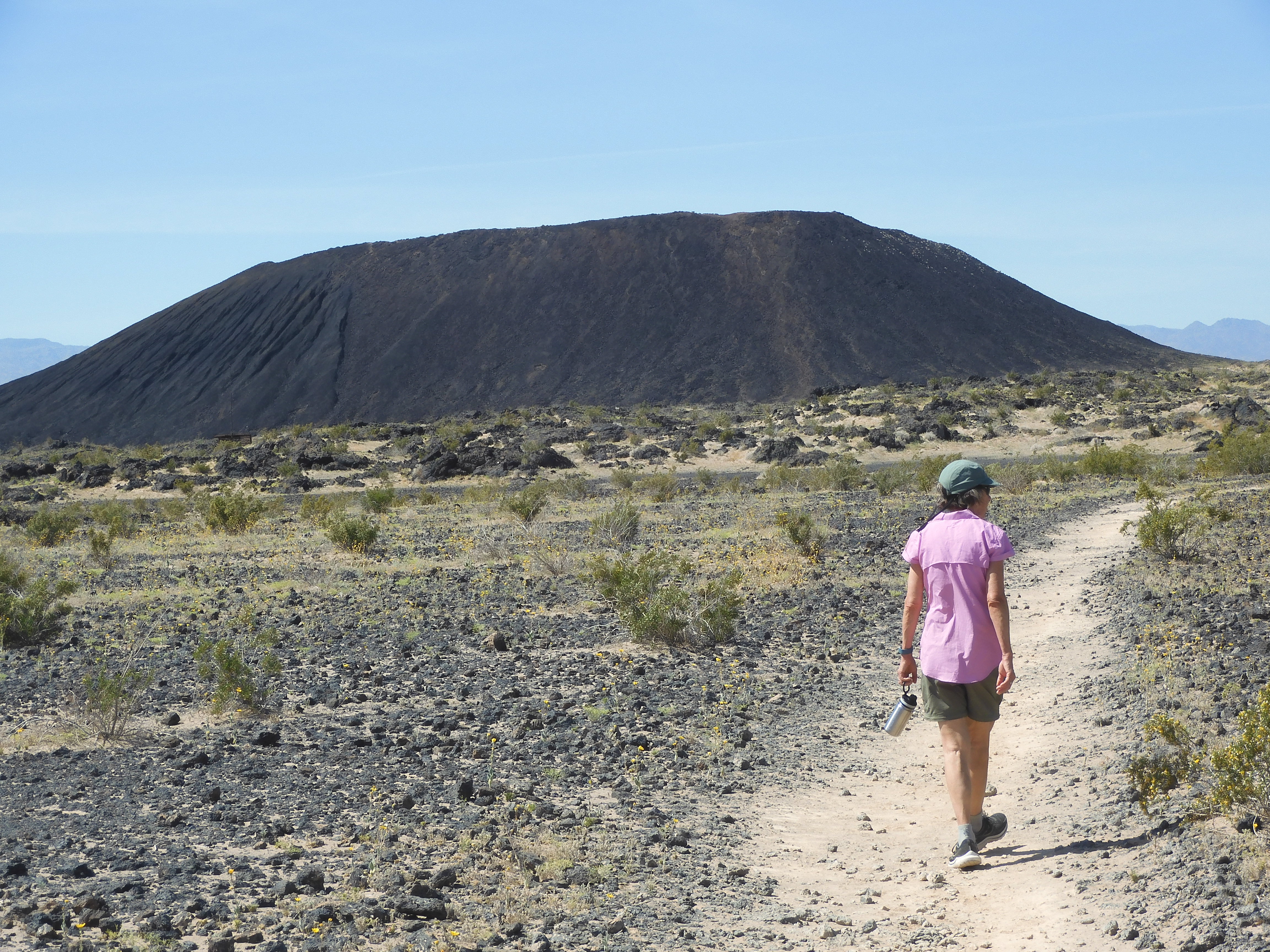
I knew I’d heard of Needles. I didn’t remember that I’d likely heard of Needles, California because of the record breaking heat. We could drive there on ROUTE 66 and it turned out Needles had plenty of motel vacancies. The best stop in route was the Amboy Crater the basalt remains of a volcano.


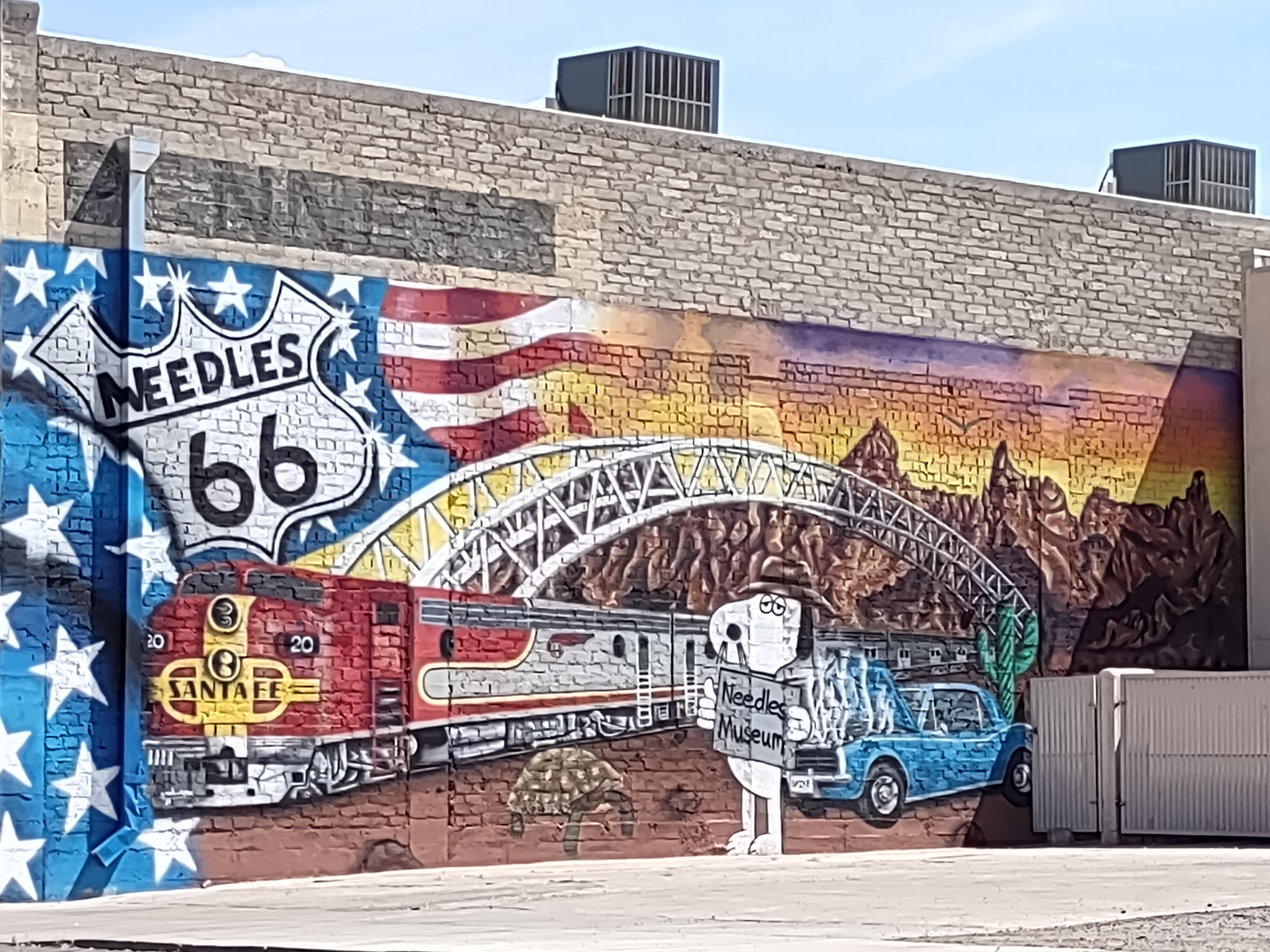
The next stop was Needles. Not a town you want to spend a lot of time outside exploring and not many inside attractions open. We took some pictures of downtown Needles and walked around the famous but closed Harvey House hotel and train station. Sadly the only people using the building appeared to be down & out folks trying to keep in shade . A woman with a child scurried away as we approached. It was very sad.


When it neared 3pm we checked into the Days Inn. The pool was closed so we stayed in our room with AC until time for dinner. We took a walk around the nearby city park that night and in the morning and that was it for adventures in Needles. The thermometer picture was taken about 5pm in our motel’s shady hallway. I decided the best activity in Needles must be swimming. For a small town they had a very nice municipal pool.


Las Vegas Redux
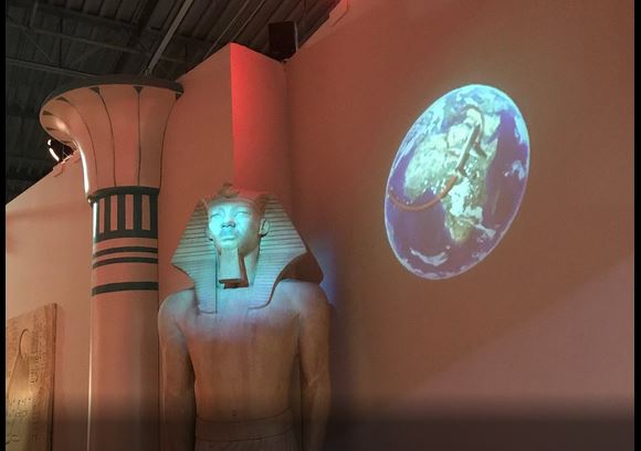
We drove out of Needles about 10am after our extremely warm morning walk. What to do in Las Vegas until motel check-in time. We’re not sure if we made the right decision going to the Natural History Museum. We didn’t think we would get $35 worth of enjoyment from the Mob Museum as opposed to $12. The museum seemed old school. I particularly enjoyed the motion triggered mummy that spoke to me as I entered the Egyptian exhibit. We spent the night at a run down Howard Johnson Motel. It was a little bit scary but it was across from the MGM Grand and very close to the airport.


We were home the next morning and are now happy to be having our hiking adventures near Spokane with a lot less people along the trail.